
Middle Atlas Mountains
Positioned between the Middle Atlas Mountains and Atlas Mountains, it is a great location for adventures in this region of the country.
Middle Atlas
The Middle Atlas is a mountain range located entirely in Morocco and is part of the larger Atlas Mountains system. It is the northernmost of the three main Atlas ranges in the country. The Middle Atlas is situated north of the High Atlas, separated by the Moulouya and Oum Er-Rbia rivers. To the south, it is bordered by the Rif mountains, with the Sebou River acting as the dividing line.
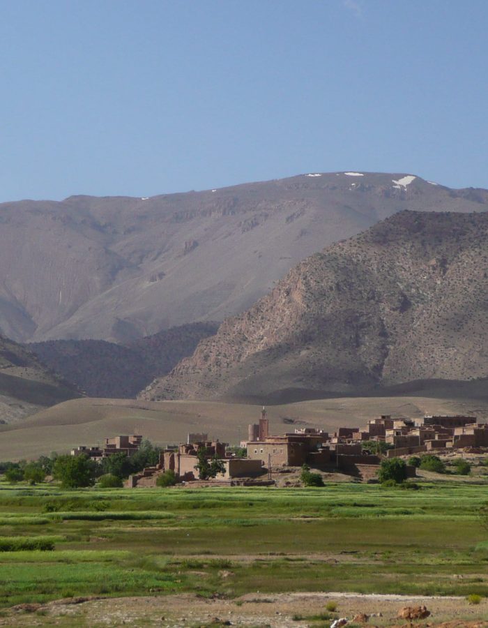
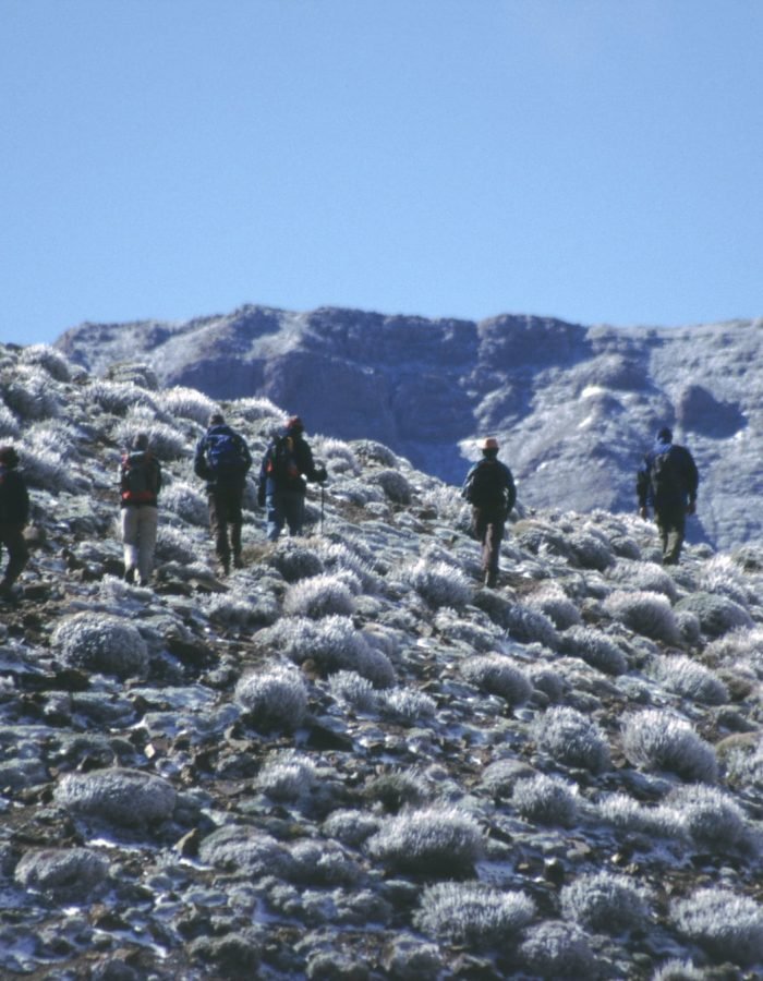
The Middle Atlas features diverse and picturesque landscapes, including forested areas, lush valleys, and rocky peaks. Its terrain consists of a series of plateaus and basins, with elevations ranging from 1,500 to 3,000 meters. The highest point in the Middle Atlas is jbel Bou Naceur, reaching an elevation of 3,340 meters.
One of the notable characteristics of the Middle Atlas is its relatively higher rainfall compared to the southern Atlas ranges. This makes it an important water catchment area for the coastal plains of Morocco. The abundant water supply supports a variety of vegetation, including cedar and oak forests, as well as numerous rivers and lakes.
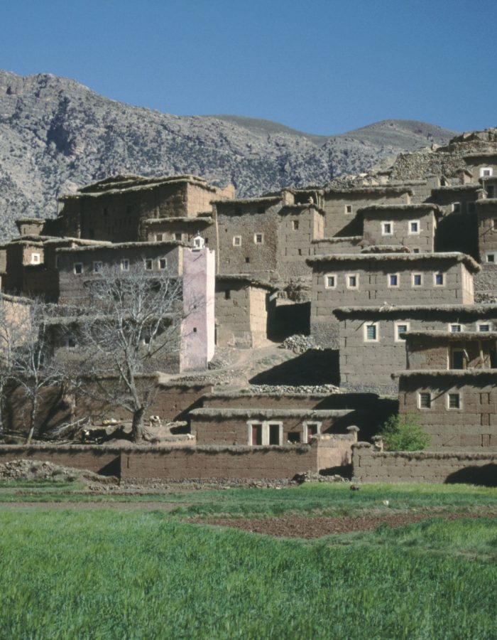
The Middle Atlas is home to diverse wildlife, such as Barbary macaques, wild boars, and various bird species. It is also inhabited by Berber communities, who have preserved their traditional way of life and cultural practices in this region.
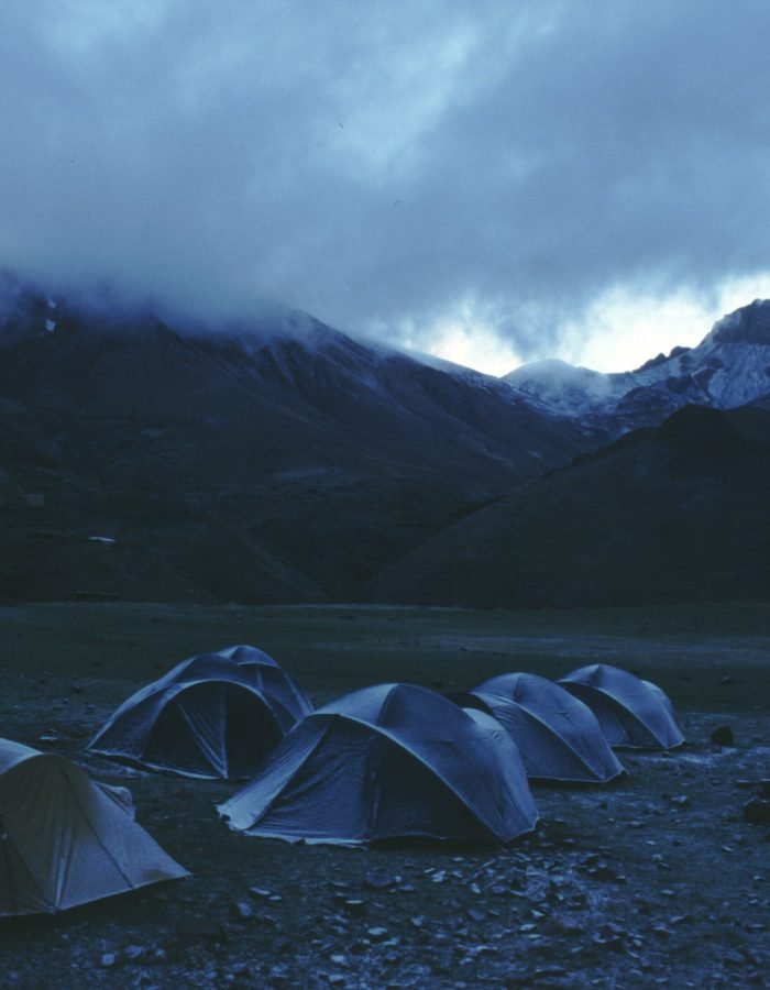
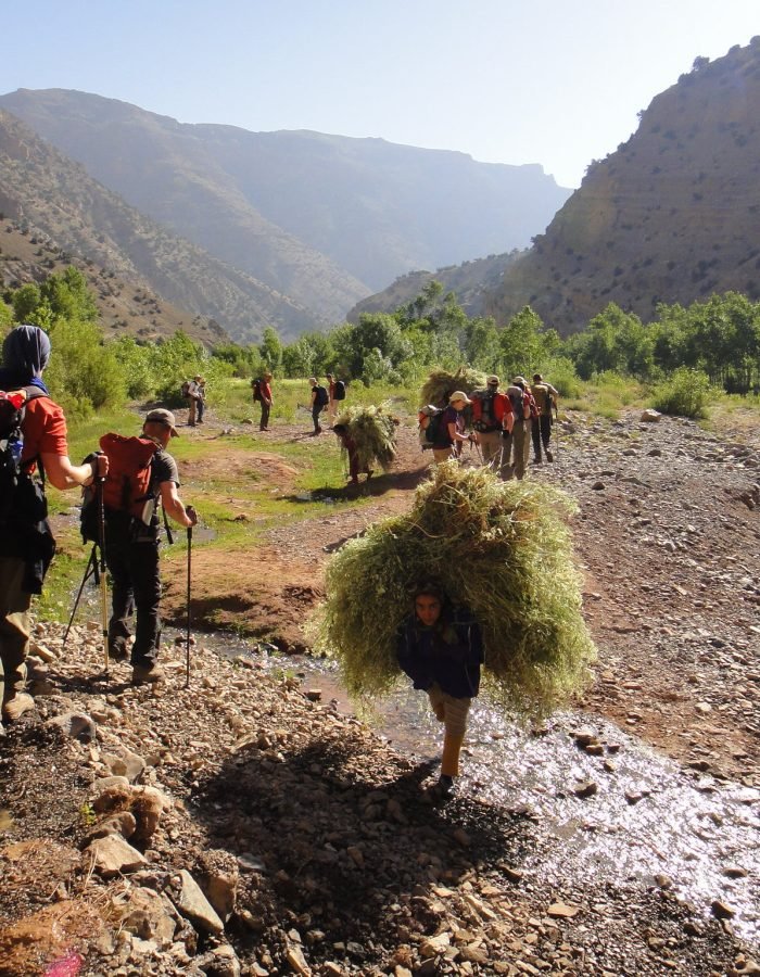
The Middle Atlas offers opportunities for outdoor activities such as hiking, trekking, and nature exploration. Visitors can embark on scenic trails through the mountains, encountering beautiful landscapes, traditional villages, and stunning vistas along the way. The region’s natural beauty, coupled with the warm hospitality of the local people, makes it an enticing destination for those seeking an authentic Moroccan experience.
In addition to its natural attractions, the Middle Atlas is also known for its charming cities and towns. Visitors can explore places like Ifrane, known as “Little Switzerland” for its alpine architecture, or Azrou, renowned for its vibrant weekly market and nearby cedar forest.
Overall, the Middle Atlas offers a unique blend of natural beauty, cultural heritage, and outdoor adventure, making it an appealing destination for travelers looking to immerse themselves in the diverse landscapes of Morocco.
Geography:
Relief:
The geo-morphological structure of the Middle Atlas is essentially composed of:
limestone rocks:
tabular rocks in the west, from an altitude of 1,000 to 1,500 meters;
folded rocks to the northeast, at a higher altitude often exceeding 3,000 meters (highest point: Jebel Bou Naceur, 3,356 meters);
volcanic plateaus.
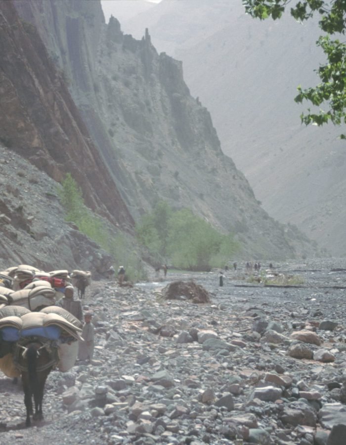
On its slopes, vast cedar forests stretch as far as the eye can see, interspersed with deep valleys. Bordered by the rich plain of Saïs and the cities of Fez, Meknes and Beni Mellal, the mountain ranges of the Middle Atlas are the stronghold of Berber tribes with a very sparse population, speaking Tamazight.
Cedar region of Khenifra-Krouchen
Panoramic landscape of Itto overlooking the city of Azrou
The Middle Atlas massif is crossed by one of the main access roads to southern Morocco, from Meknes to Tafilalet. Located northeast of the Atlas. The Middle Atlas is closed to the east by the Tazekka National Park, with landscapes carved with gorges and caves. To the south of Sefrou, forests of cedars, holm oaks and cork oaks alternate with bare volcanic plateaus and small fish-filled lakes with turquoise waters.
The jewel of the Middle Atlas is Ifrane National Park, located in the Atlas Causse2 between Khenifra and Ifrane, Khenifra National Park and Tazekka Park, classified Ramsar3 according to the agreement with Morocco.
The Highlight :
- Scenic Beauty: Explore the picturesque landscapes of the Middle Atlas, with its lush valleys, cedar forests, and snow-capped peaks.
- Cultural Encounters: Encounter the local Berber communities and immerse yourself in their rich traditions, customs, and warm hospitality.
- Outdoor Adventures: Engage in exciting outdoor activities such as hiking, trekking, and wildlife spotting in the Middle Atlas Mountains.
- Water Resources: Discover the importance of the Middle Atlas as a crucial water catchment area, contributing to the rivers and plains of Morocco.
- Serene Retreats: Enjoy the tranquility of charming mountain towns and resorts nestled in the Middle Atlas, offering a peaceful getaway.
- Historic Sites: Visit historical landmarks and ancient ruins scattered across the Middle Atlas, showcasing the region’s fascinating past.
- Wildlife and Nature: Encounter diverse flora and fauna, including the famous Barbary macaques, in the protected areas of the Middle Atlas.
- Cultural Heritage: Explore traditional Berber architecture, vibrant markets, and local crafts in the towns and villages of the Middle Atlas.
- Scenic Drives: Take memorable road trips along winding mountain roads, offering breathtaking vistas and panoramic views.
- Adventure and Relaxation: Combine thrilling outdoor adventures with rejuvenating experiences at spa resorts and natural hot springs.
Hydrography:
the Middle Atlas region in Morocco is characterized by its diverse and intricate hydrography, with numerous rivers, lakes, and watercourses that shape the landscape and provide essential resources for both nature and human settlements.
The rivers of the Middle Atlas, such as the Oum Errabiaa, Moulouya, Sebou, and Bouregreg, originate from the surrounding mountains and traverse the region, carving deep valleys and gorges along their paths. These rivers are fed by rainfall, snowmelt, and natural springs, ensuring a steady flow of water throughout the year.
The lakes of the Middle Atlas add to the hydrological richness of the region. The most prominent is Lake Ifni, a stunning alpine lake nestled amidst the mountains, known for its crystal-clear waters and scenic surroundings. Other notable lakes include Lake Aguelmam Azigza, Lake Dait Aoua, and Lake Tislit, each with its unique charm and ecological significance.
Atlantic Ocean:
the Sebou basin: with an area of about 40,000 km2;
the Oum Errabiaa basin: covers 35,000 km2;
the Bouregreg basin: covers an area of around 10,000 km2;
the Moulouya basin: rises in Almssid at the junction of the Middle and High Atlas stretches over 74,000 km2 and flows into the Mediterranean.
The contributions are therefore quite abundant and the flows relatively regular. The equipment in cascading hill dams of this region aims to protect the downstream, to improve the tourist attractions of the region and to create water reserves favoring the development of arboriculture which continues to grow. thanks to various international programs such as that of Oued Serou.
Middle Atlas Lakes:
Most of the Middle Atlas lakes are concentrated in the geographical area of Beni Mellal-Khénifra-Ifrane corresponding to the Middle Atlas Causse.
- Lake Aguelmame
- Azegza
- Lac Ouiouane
- Lake Tiguelmamine
- Lake Aguelmame Sidi Ali
- Lake Dait Iffer
- Lake Dait Aoua
- Lake Bin El Ouidanne
- Middle Atlas Waterfalls
The Ouzoud waterfalls attract many visitors. Located 22 km from Tanaant, a little over 80 km from Beni Mellal and about 150 km from Marrakech, in a region where there are many waterfalls, this corresponds to a fall of 110 m in height for the waters of the river. Ouzoud which then join the El Abid wadi. The basin of limestone rocks is surrounded by lush flora.
Dams:
- Dams of the Oum
- Errabiaa basin
- Sebou basin dams
- Bouregreg basin dams
- Dams of the Moulouya
- basin: upper and lower
- Moulouya
The Weather:
The Middle Atlas region of Morocco is known for its diverse and unique climate. Situated between the High Atlas and the Rif mountains, it experiences a range of bioclimates and environmental influences. From humid and sub-humid areas to semi-arid and dry Saharan zones, the Middle Atlas showcases remarkable bioclimatic variety.
This diversity is attributed to Morocco’s geographic position between Europe and Africa, allowing for the exchange of genetic materials and exposure to different climatic factors. The region is home to 30 bio-geographical zones and 39 terrestrial ecosystems, including 30 forest ecosystems. With over 4,700 plant species, including more than 70 forest trees, the Middle Atlas boasts exceptional biological richness.
However, this natural heritage faces significant threats from human activities, which can have catastrophic effects on biodiversity and the overall ecosystem. The revival of cultivable land at the expense of forests, desertification, and climate change-induced drought are among the challenges faced by the Middle Atlas.
The region is characterized by iconic cedar forests, such as Ajdir Izayane, Ain Leuh, Azrou, Ifrane, and Immouzer Marmoucha. These majestic trees contribute to the contrasting landscapes of the Middle Atlas, offering a serene atmosphere filled with the perfumed scents of cedar and Thuja.
The Middle Atlas also features the circuit of the lakes, which takes visitors through wild and mountainous landscapes, green plateaus, and vast forests inhabited by magot monkeys. While the region holds potential for eco-tourism, there is still a need for infrastructure development to benefit the local populations living in poverty.
Despite its natural beauty, the Middle Atlas ecosystem faces ecological pressures, including population dynamics, drought, excessive forest exploitation, and habitat degradation from overgrazing. These factors have irreversible impacts on the region’s delicate balance.
From the eastern part with its deep valleys and high peaks like Jebel Bou Naceur and Jebel Bouiblane, to the sparsely populated high plateaus between Azrou and Timahdite, and the wetter western slope with its forests of cedars, cork oaks, and maritime pines, the Middle Atlas offers diverse landscapes.
Transhumance, the seasonal movement of people and their herds, is still practiced in the Middle Atlas by the Beni M’guilds and the Berber Zayanes of Khenifra. They migrate with their livestock to green pastures in the spring and descend to the temperate plains to escape the harsh winter climate.
Notably, the region of Khénifra serves as a vital water source, with its network of rivers forming the Oum Errabiaa and Bouregreg basins, contributing to its status as a “water tower.”
The climate of the Middle Atlas is a fascinating blend of natural phenomena, diverse ecosystems, and human interactions, making it a captivating region to explore and protect.
The Story:
Once upon a time in the Middle Atlas region of Morocco, a land of captivating landscapes and diverse climates, a remarkable story unfolded. This story revolved around the delicate balance between nature and human existence, showcasing the interplay of bioclimatic influences and the challenges faced by the ecosystem.
Nestled between the High Atlas and Rif mountains, the Middle Atlas stood as a bridge connecting Europe and Africa. Its strategic location allowed for the exchange of genetic materials, resulting in a rich tapestry of flora and fauna. The region boasted 30 bio-geographical zones and 39 terrestrial ecosystems, each with its own unique character.
As time passed, the Middle Atlas faced numerous threats to its precious biodiversity. Human activities, driven by the pursuit of cultivable land, began to encroach upon the once-thriving forests. The argan tree, which once populated the valley of Wadi Grou, slowly disappeared as desertification and human interference took their toll.
Amidst these challenges, the Middle Atlas remained a sanctuary of natural wonders. Majestic cedars, such as Ajdir Izayane, Ain Leuh, Azrou, Ifrane, and Immouzer Marmoucha, adorned the landscape, their branches reaching for the sky. These ancient trees guarded the secrets of the region, sheltering diverse wildlife and creating a serene ambiance filled with the scents of cedar and Thuja.
One of the Middle Atlas’ hidden treasures was the circuit of the lakes. This enchanting journey led explorers through untamed mountains, verdant plateaus, and sprawling forests inhabited by playful magot monkeys. It held the promise of eco-tourism potential, yet much work remained to develop this untapped heritage and provide sustainable opportunities for the local communities burdened by poverty.
But the Middle Atlas was not immune to the ecological pressures of the modern world. The dynamics of a growing population, coupled with the encroaching drought caused by changing climatic patterns, posed significant challenges. The excessive exploitation of the forest and the overgrazing of habitats threatened the delicate balance of this precious ecosystem.
Despite these hardships, the Middle Atlas persevered, showcasing its resilience and adaptability. Its varied landscapes offered something for everyone — from the rugged peaks of Jebel Bou Naceur and Jebel Bouiblane to the tranquil high plateaus between Azrou and Timahdite. The western slopes, blessed with more rainfall, became a haven for agriculture, attracting those seeking fertile lands.
The Middle Atlas also served as a backdrop for the age-old tradition of transhumance. As winter’s grip tightened, the Beni M’guilds and the Berber Zayanes of Khenifra embarked on their seasonal migration. With their herds in tow, they traversed the land, seeking greener pastures and temperate plains, symbolizing the harmonious relationship between humans and nature.
In the heart of the Middle Atlas, the region of Khénifra emerged as a water tower, blessed with a network of rivers. The Oum Errabiaa and Bouregreg basins ensured the flow of life-giving water, sustaining not only the ecosystem but also the communities that relied on its abundance.
The story of the Middle Atlas was a tale of challenges and resilience, of human interaction and the awe-inspiring power of nature. It stood as a reminder of the delicate balance required to protect and preserve our natural heritage for generations to come. The Middle Atlas beckoned adventurers, storytellers, and nature enthusiasts alike, inviting them to explore its hidden depths and discover the beauty that lay within.
Exploring the Ecological Riches of Morocco's Middle Atlas
A reorganization and clarification of content are necessary to improve it. Here are some areas for improvement:
- Bioclimatic Diversity: Morocco’s unique geographical position between Europe and Africa has resulted in remarkable bioclimates and diverse natural environments, including forests, deserts, and various ecosystems.
- Biodiversity and Threats: Morocco boasts exceptional biological richness, with thousands of plant and animal species. However, human activities pose serious threats to biodiversity and ecosystems, with potential catastrophic consequences.
- Environmental Challenges: Challenges such as deforestation, desertification, and drought due to climate change and pollution affect Morocco’s natural heritage and ecosystems.
- Cedar Forests: The Middle Atlas is home to majestic cedar forests, such as Ajdir Izayane, Ain Leuh, Azrou, and Ifrane. These forests offer contrasting landscapes and house diverse wildlife, creating a serene and aromatic atmosphere.
- Lakes and Wild Landscapes: The region features the scenic Lakes Circuit, characterized by high mountains, green plateaus, vast forests, and the presence of the endangered Barbary macaques.
- Sustainable Development: There is untapped potential for eco-tourism in the Middle Atlas, but efforts are needed to develop appropriate infrastructure and uplift local communities affected by poverty.
- Ecological Pressures: Population dynamics, increasing drought, excessive forest exploitation, and overgrazing pose irreversible ecological pressures on the Middle Atlas ecosystem.
- Landscape and Transhumance: The Middle Atlas offers diverse landscapes, from dry eastern regions to wetter western slopes covered in cedar, cork oak, and pine forests. The area is known for transhumance, where local populations migrate with their herds to seek green pastures.
- Water Resources: The Khénifra region serves as a significant water source, with its river network and hydraulic basins formed by the Oum Errabiaa and Bouregreg tributaries.
